Geographic Information System (GIS) can integrate geographic data, statistical data, analysis, and visualization into a single platform that provides strong support to neighborhood planning. APD-U’s vital integration of ESRI and other GIS-related software into our planning process provides our clients with first-in-class problem diagnosis capabilities. This case study introduces APD-U’s work flow and unique integration of spatial analysis tools for every step of our work process.
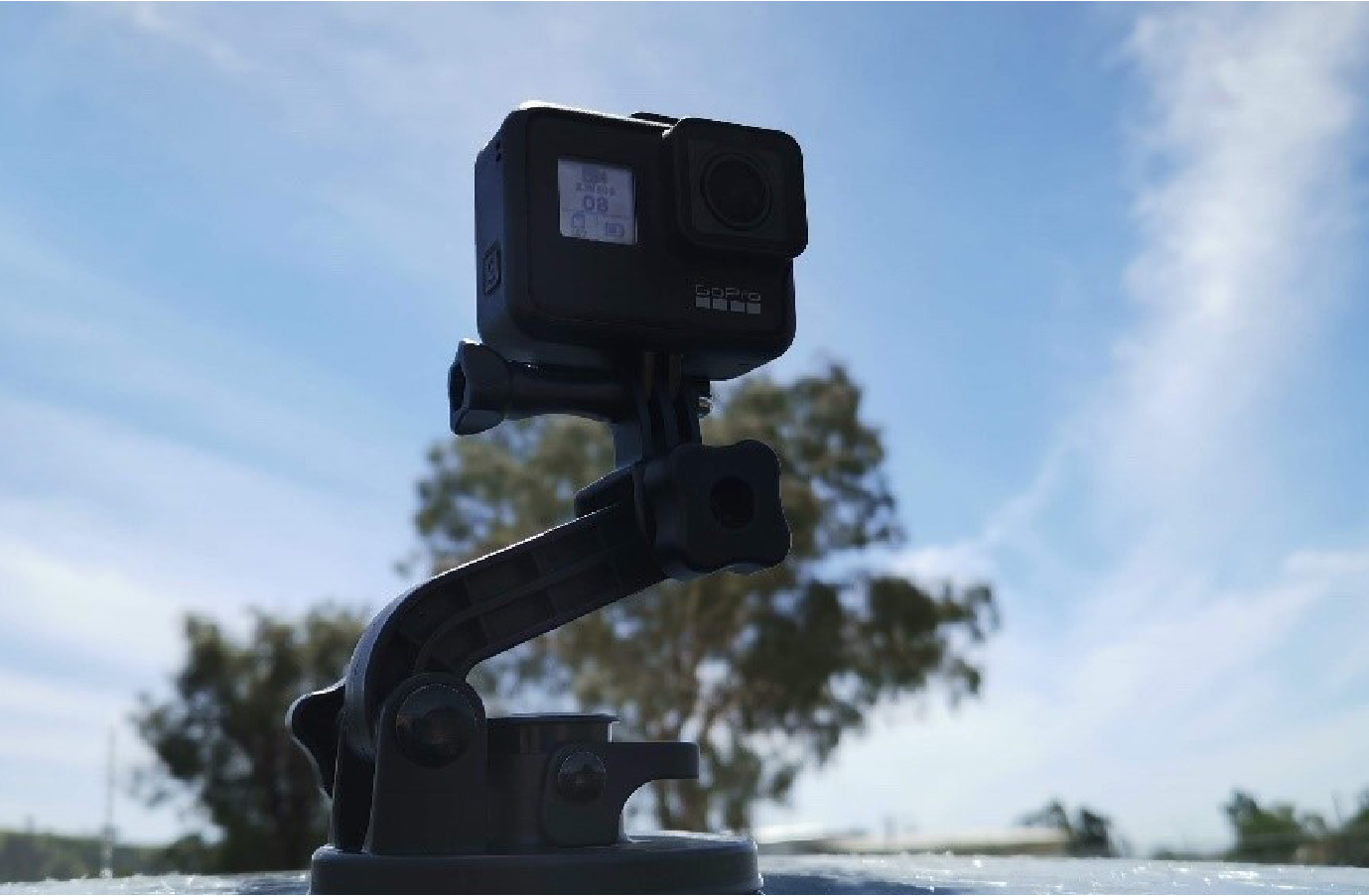
APD-U uses a range of technologies and instruments to capture the data that defines a neighborhood. After collecting open source data APD-U will conduct an on-site survey to collect up-to-date physical conditions of property. The result of the survey is a database of all relevant data of all parcels and buildings within the community. In this process, APD-U utilizes 360 cameras and ESRI field work applications, for example, ESRI Survey123 and Workforce, to systematically obtain, update, and manage the data.
As part of the real-time data management process, APD-U integrates field data with various supplementing data, like tax assessor records. APD-U cleans and processes this information to ensure accuracy and effectiveness. APD-U delivers informative and interactive presentations so that our clients can gain a better understanding of their neighborhoods.
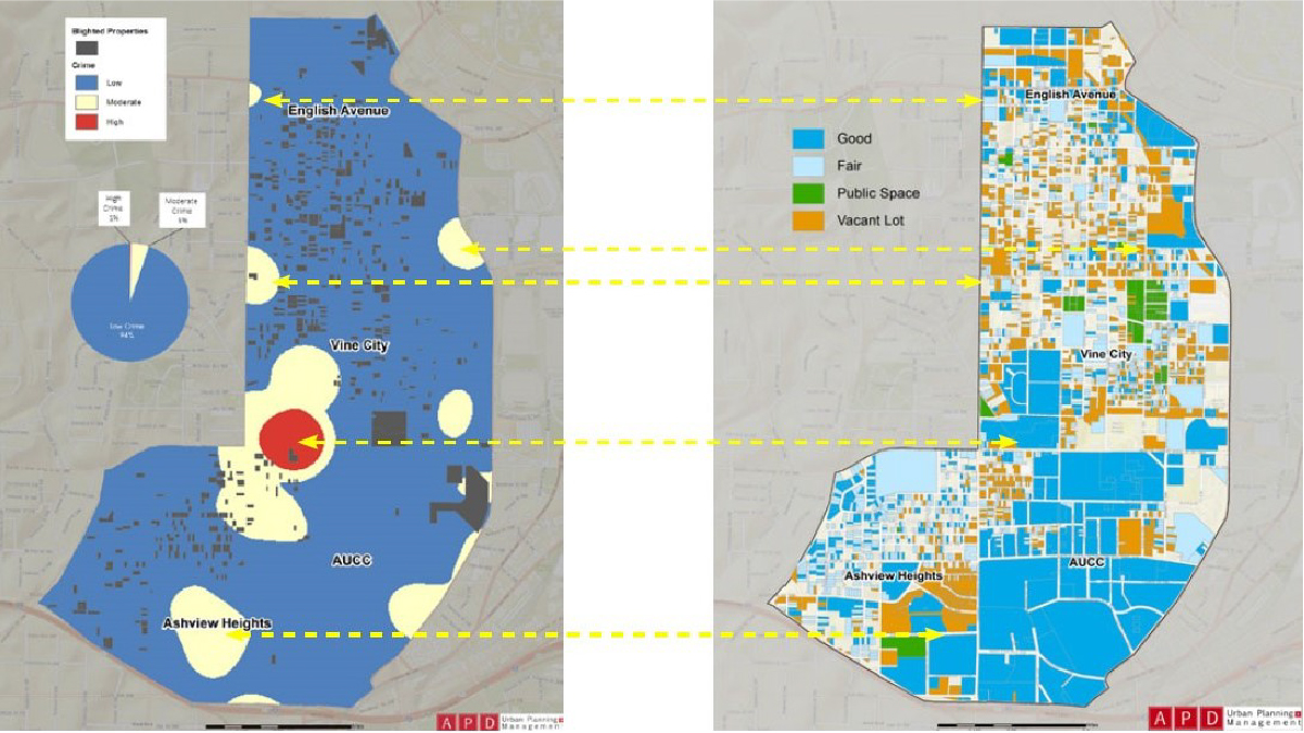
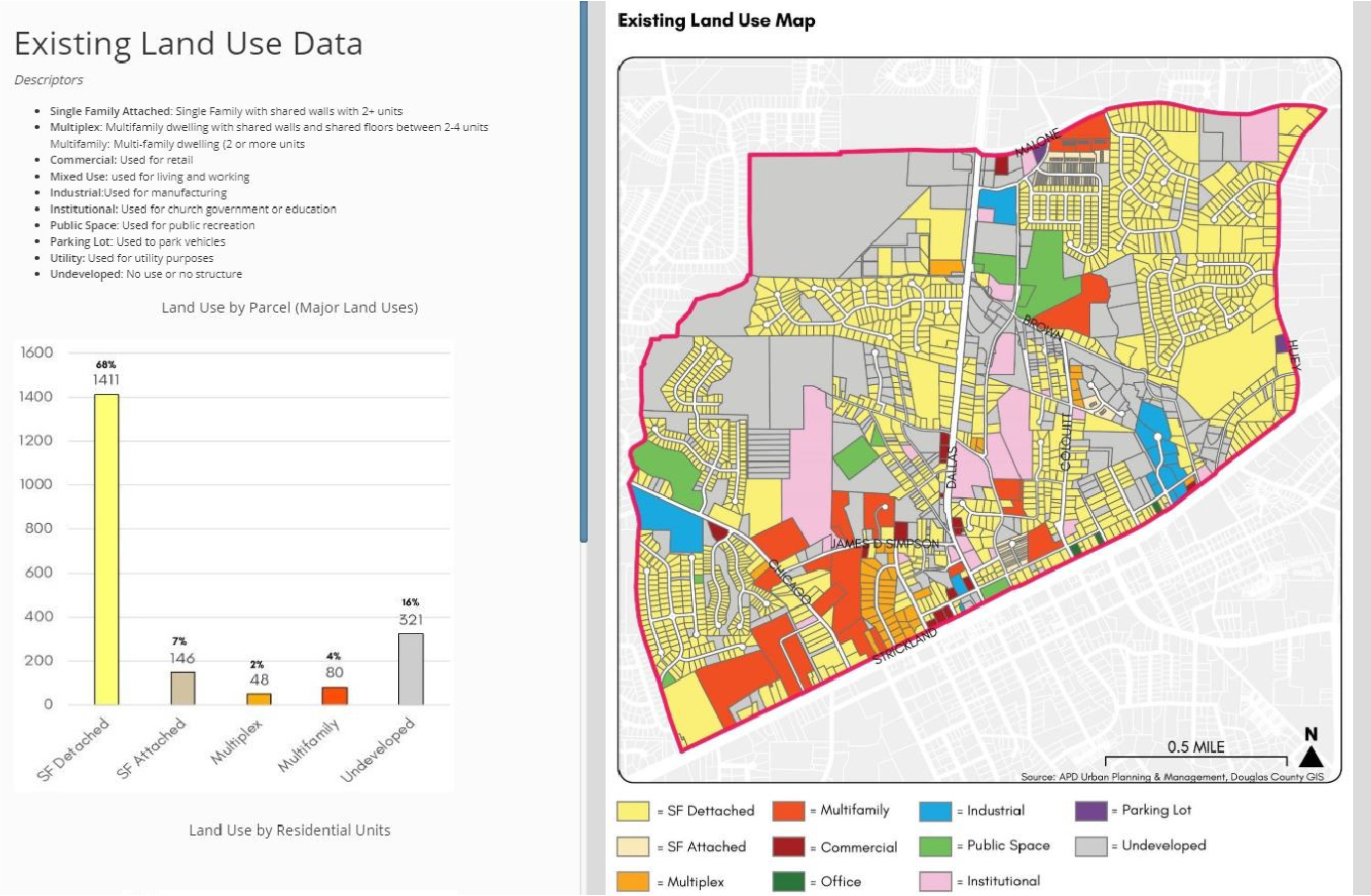
APD-U conducts instructional condition analysis with the processed neighborhood data. APD-U uses GIS to overlay condition information layer with zoning, boundaries, or environmental layers. APD-U utilizes GIS as a platform to collect spatial and non-spatial information that needed for zoning maps and land use analysis.
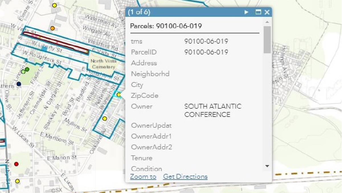
GIS tools are used for communication among APD-U, our client, stakeholders, and the community. In addition to community meetings, Survey123 helps APD-U collect descriptive and geographical information intuitively from the clients or other groups. APD-U also creates interactive online maps that reflect real-time feedbacks. For example, APD-U created a property acquisition online map for the City of Florence, SC.
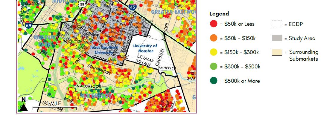
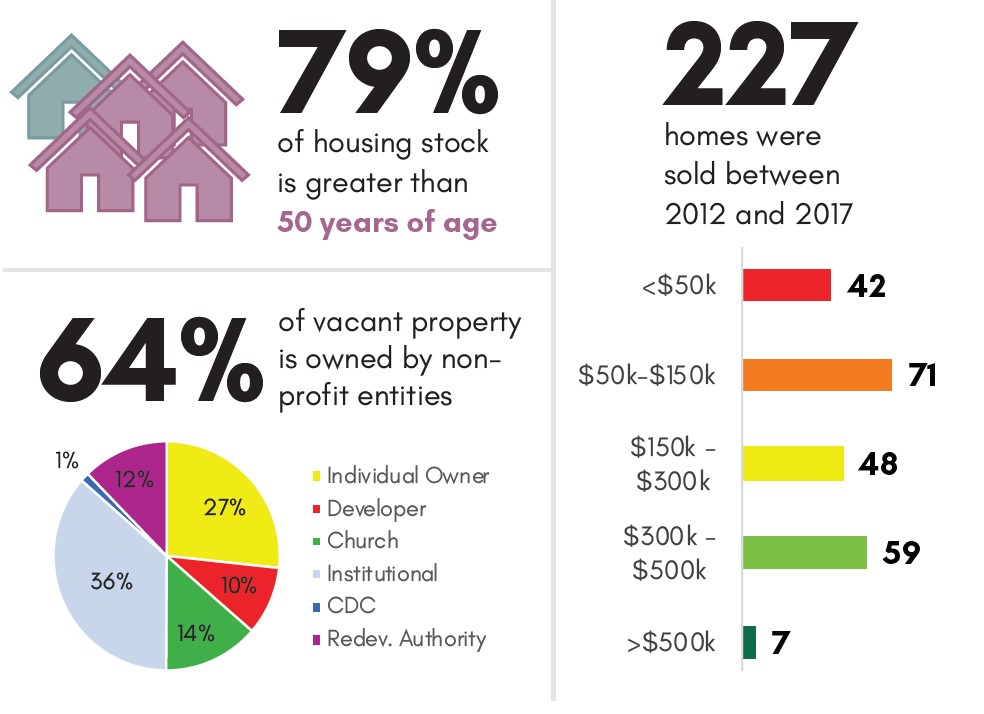
APD-U’s affordable housing expertise relies heavily on GIS integration. In this process, APD-U uses GIS to accurately locate housing projects at different affordability ranges, creating a set of numbers, maps, and infographics to inform the creation of housing production targets. GIS is used to locate and visualize target areas and their related site conditions.
APD-U presents the client with an initial design, including a detailed pro forma, and collects feedback. As a next step, APD-U analyzes the market dynamic, revises the design and pro forma, updates the database accordingly, and presents the revised plan in several stages. The supporting data for design and design documents are integrated into the GIS platform.
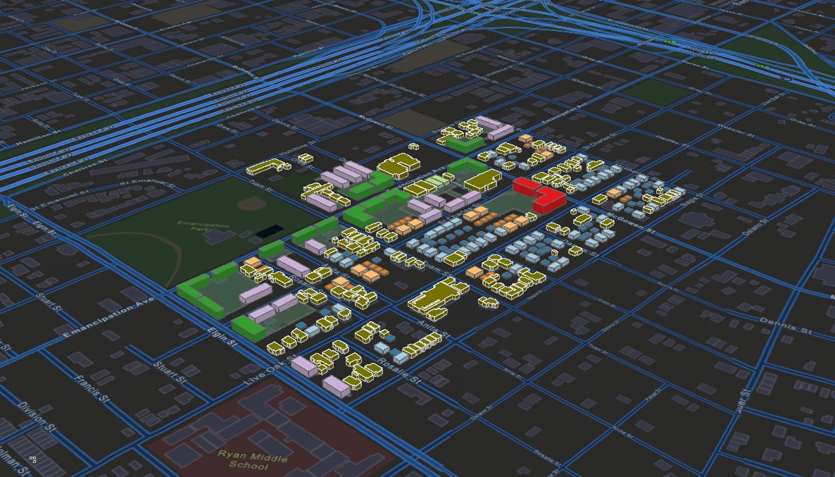
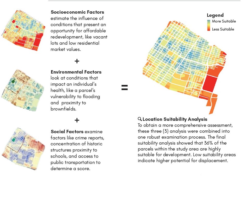
APD-U uses various GIS analytical tools to support policy making by building capacities, analyzing various factors, and generating technical reports. For example, APD-U created a Housing Development Suitability map for Houston’s Historic Third Ward neighborhood by combining a wide array of relevant factors.
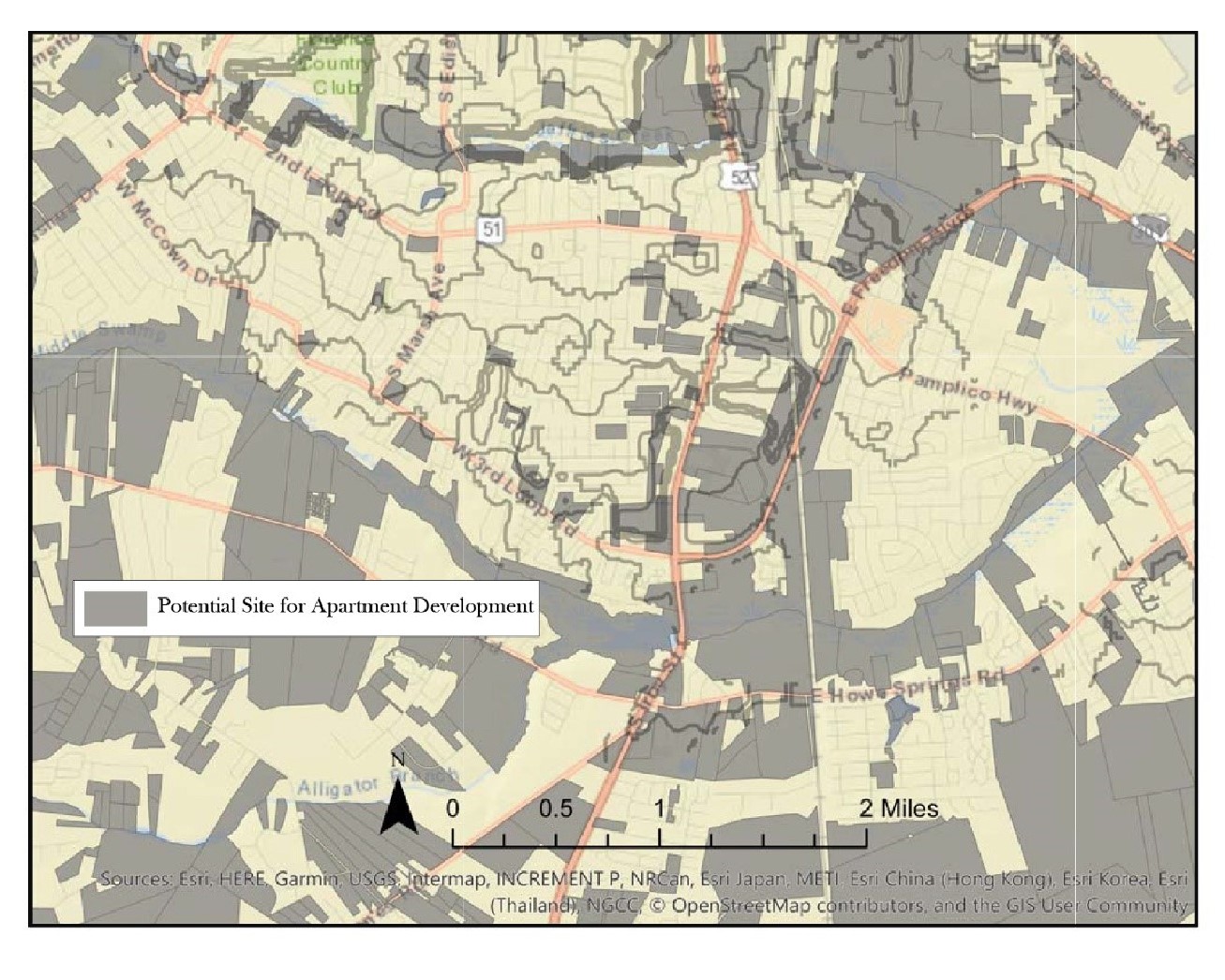
APD-U incorporates geographic data and market data into all our real estate-related projects. For example, APD-U created an analytical report for the City of Florence with a list of potential sites for a multi-family development project that meets the criteria of South Carolina’s Qualified Allocation Plan.
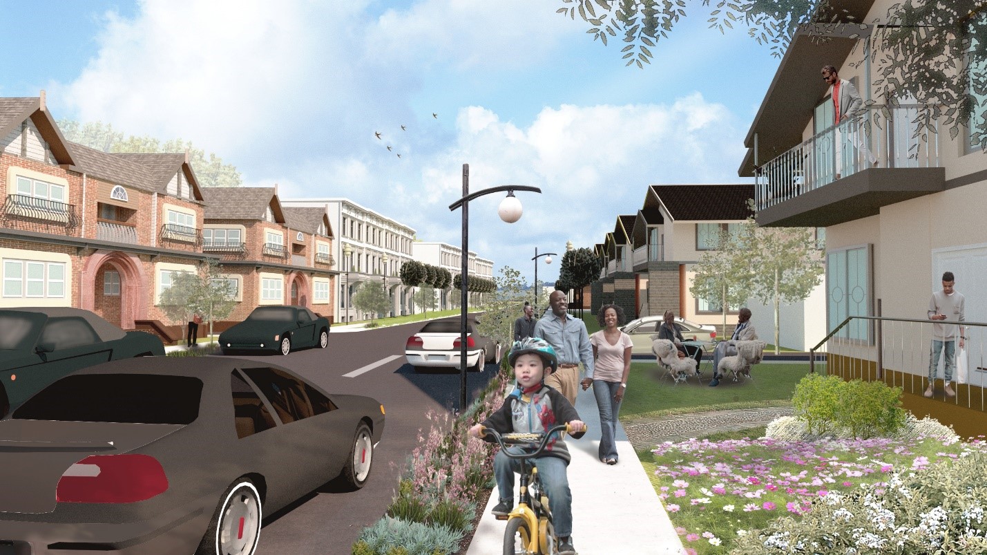
GIS data and analysis helps to inform APD-U’s site planning and design work. APD-U creates site plans in ArcGIS Pro which can be developed into 3-D models. Architecture drawings and renderings are created outside of the GIS Platform, and will be integrated with the GIS platform through online maps and reports.
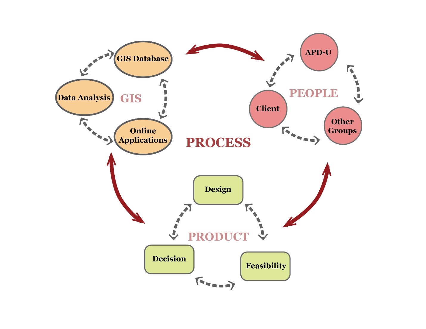
APD-U’s GIS systems process connects the community to the final product. APD-U’s drive to innovate results in the latest and most cutting-edge technologies in planning.